

I knew I had week off coming up in April and unfortunately due to bad timing it was the week after my kids’ spring break. So here I am with a week off and wanting to make the best of it. I’ve been itching to go to Antelope Canyon ever since I saw Scott Kelby’s shots from his 2007 trip. Since I had a week off I decided to make the best of it and go on a photographic adventure. No family, no friends, just “me time.” Time to do things on my own, explore and just be me. So I really started asking Scott about the locations he went to and as luck would have it, he told me that everyone else told him the best time to go was in April! I said, OK that’s it I’M GOING! I booked a room with a non-refundable deposit at the Courtyard Marriott in Page Arizona and now I was committed. Next I booked my flight and rental car.
First stop, Horseshoe Bend!

Any landscape photographer will tell you that the best times to shoot landscapes are in the morning (sunrise) and the evening (sunset). The reason for this is the sky looks its best and has the most beautiful color at these times. It’s almost magical!

An example of that magical sky I was talking about. Sunset in San Francisco at Coit Tower.
So I drove from the Phoenix airport (4 hours) directly to Horseshoe Bend to try to catch the sunset. I got there in what I thought was enough time until I realized that after climbing the first steep hill, it was about a mile to Bend. I was really hoofing it to race the sun and make it to the “cliff” in time. I got there setup my tripod and started shooting.
Although I got the shot, I would have liked to have had a little more time to capture it from a few more vantage points. After I got the shot I learned my first lesson about shooting in the desert. I turned around to head back to the car only to see a horizon and terrain that all looked the same. If there hadn’t been other people walking ahead of me off in the distance I could have easily walked back in the wrong direction. I wouldn’t have been lost, because I knew the general vicinity of the car. However, I could have walked several hundred yards out of my way.
I used to laugh when I saw the iPhone commercials advertising the apps that help you find your car. I downloaded one of those apps the minute I got back to my room!
Antelope Canyon, the main reason for my trip

Scott started telling me about other places that he learned about after his trip that he wished he had photographed. One was Horseshoe Bend. While all of the spots he was telling me about were interested and definitely worthy of capturing, I had my heart set on the slot canyons. I was awestruck by the sheer beauty and colors of these magnificent canyons.
Like I said above, the best time to shoot landscapes is in the early morning and in the evening. However, for the slot canyons, you actually have to wait a little longer until the sun is a little higher in the sky to get the beams of light coming down. Since the sky isn’t the main focus of these shots. It makes sense.

So since I had a sunrise coming and didn’t want to waste it, I headed to the closest “Scenic View” point to grab some shots of the lake. Unfortunately, there wasn’t really much magic in the light because the sky was completely clear. It’s the sun lighting up the clouds in the sky that really makes the shots pop. Although I got a couple decent shots, nothing was really setting me on fire until I turned around and saw my rental car. The sun was lighting the Mustang perfectly! It looked like a car ad. So I grabbed a couple shots and was happier with those than my lake shots.

I went back to the hotel, had breakfast and headed out to the slot canyons. There are actually two different locations to shoot the famous canyons. There are the upper slots and the lower slots. It seems like the Lower Slots are for the pros and the upper slots are for the tourists. My guess is that because you have to physically climb down into the lower slots, that most average travelers aren’t going to go through the hassle.

This is actually the entrance to the Lower Slots. You just start climbing down gear and all.
When I got down into the lower slots every photographer down there had a tripod and an dSLR. There were only about 10-12 people down there. So there was plenty of opportunity to get shots without anyone being in your way. Most of the folks down there were on a tour. I had heard that the tour of the lower slots wasn’t worthy it and you could just pay and go on your own. That’s what I did! The lady at the desk asked me if I was going to be taking pictures? I said “yes” and she then handed me a sticky note to wear that said “Ken’s Photography Tours.” She told me that I would have 4 hours to shoot. Wow! 4 hours? Not sure who Ken was, but I was glad to have the extra time with no rush.
The lower slot canyon is MAGNIFICENT! It’s hard to get a bad photo there. Also because there are so many different angles and vantage points, no two photographers are going to walk away with the exact same shots. I got exactly what I came for!
Although I was totally happy with what I got in the Lower Slots, I decided to head to the Upper Slots on the other side of the road (about 1/4 mile down). This canyon required that you actually go with a group. They have to drive you to the entrance, which is about a mile (or more) away from the parking lot. Although you’re in a group with a guide, the guide was totally cool with you taking your time to get the shots you wanted. I was probably the only Pro Photographer in this group and I have a theory as to why. The best light had already past for the day. It was after 2PM and to shoot the Upper Slots to get the beams of light that you would want, you have to do it between 11AM and 1PM. I was amazed by how friendly the guide was in that he was even taking the time to help people change the settings on their point and shoot cameras to get the best results.

I was the only one in this canyon with a tripod and YOU NEED A TRIPOD! Most of the time I shot in Aperture Priority Mode which means you set your desired f stop and let the camera figure out the shutter speed. In some spots you can easily be taking 10-30 second exposures. It’s impossible to hand hold a camera and get a non-blurry shot that long. Now of course you can crank up the ISO so that you can shoot hand held, but then you’re going to be sacrificing image quality and introducing noise. I wanted to keep my ISO at 200 the whole time. Even though I was on a tripod, I still used a cable release. This reduces the vibration that you could get by using your hand to press the shutter release on the camera body itself. If you’re a tact sharp fanatic, then you could even shoot using the mirror lockup feature.
Although I missed the beams of light for the day in the Upper Slot Canyon I was still glad that I went. It is “different”! There’s no climbing involved and it’s much wider on the inside. I planed on coming back the next day to get the beams, but that didn’t happen…
An adventure and a nightmare
Since I was done for the morning and achieved my main objective for the trip, my attention was now on “what am I going to shoot at sunset?” I started thinking about the Grand Canyon and then someone I was on the truck with coming back from the Upper Slots mentioned Bryce Canyon. They showed me a calendar that they bought with an incredible image in it. Of course I wanted to take a shot like that. So I went back to my room and reviewed the shots from the Antelope Canyon. I got so absorbed by them that I skipped lunch. Now it was 4PM and if I was going to make it to Bryce Canyon by sunset I had to leave NOW!

I plotted my course in my Garmin nuvi 765t and I was on my way. I thought for a second, “I should grab some food before I leave, but the restaurants in Page were in the opposite direction.” “I’m sure I’ll pass something on the way and grab food then.” BIG MISTAKE! I learned a hard lesson that day. I assumed that like most highways I’ve driven on in my life, there’s always a fast food place, gas station, convenience store, etc. Um NO! That isn’t always the case!
I got about 10 minutes out of Page and noticed I had no cell service. No biggie right? I now know the definition of “the middle of nowhere!” I saw NOTHING for 115 miles. Nope, nadda, nothing! No gas station, no little store, no nothing! Oh well, I’ll suck it up and get something when I get to Bryce. This is where the real fun began.
I’m a gadget guy. Although I know that gadgets are not perfect, I tend to rely on them heavily. Today was no exception. I never once looked at a map. I was blindly following my Garmin, which had never let me down. The nice lady on the Garmin told me to make a right turn. I almost skidded off the road because the right turn was on a road so small that I didn’t see it until I was right up on it. I stopped! There was a sign in front of the road that said “4 wheel drive recommended. AND ” This is NOT a road to Bryce Canyon.” Wow! OK apparently a lot of people must have been routed to that point since they made a sign for it. So I went back to main road and kept going. Of course the Garmin recalculated a new route and I had another right turn in 14 miles. This time the road was paved so I took it.
This was a road right out of a movie or car commercial. It was winding and beautiful country. Amazing scenery. Fantastic and the kind of road you would really open up on with a sports car 🙂 My next turn was coming up in about 21 miles. I enjoyed the road and got to my next turn. It was unfortunately another dirt road. However, this one was bigger and there were no 4 wheel drive signs. There were even signs telling you how far the next road, city, etc. was. I looked down at the Garmin and it said I’d be on that road for 30 miles and then basically be 6 miles away from Bryce after that. I thought about it! I really didn’t feel like taking a dirt road, but at this point it was either turn back and miss the sunset or go forward the endure the dirt road.
I started down the dirt road and for the first couple of miles it wasn’t too bad. Then things started getting a little tricky. I was going up and down hills, around bends, etc. I even crossed a couple of very very very shallow streams of water. I’m not kidding. I then noticed that I hadn’t seen another vehicle yet. I also noticed that there were only one or two houses every 5-6 miles. I started to freakout a little on the inside. Anyone that knows me, knows that I rarely ever freakout on the outside, but I was really starting to come unglued on the inside. I kept thinking, “if this car breaks down or if I get multiple flat tires I’M SCREWED!” I had no cell service, no food, a very small amount of water and I was alone! No one knew where I was at this point. Then the adventure got kicked up a notch. The road started winding up and down and around the mountains. There were NO GARDRAILS! Nope, nadda, nothing. You drive a few feet to far to the right and start sliding and you’re off the edge of a very steep cliff. I’m not afraid of heights, but I’m definitely afraid of falling! On the inside I was bouncing off the walls! I was thinking that If something happens, I’ll never be heard from again. Rocks were hitting the under carriage. I was spinning left and right in the sand. Most of road was like driving over one long series of speed bumps. I was also secretly wishing that this Mustang was KITT from Night Rider and could transform into a 4 wheel drive F150. Sadly, that never happened.
Yes, I know that there was a time when there were no cellphones or GPS navigation. Yes, and our parents had to walk 5 miles to school up hill both ways. I get it. Call me spoiled. I am!

This was the longest 30 miles of my life, but I finally made it back to the pavement. However, it took so long (over an hour) to drive the 30 mile death road that there was no way I was going to make Bryce by sunset. My attention turned towards “how the hell am I gonna get back to the hotel?” There is no F’ing way that I’m going back down that dirt road especially in the pitch black of the night. I got to a small town and pulled in to a strip shopping/restaurant/gas station area. I noticed the store was just closing. I walked into the restaurant to use the bathroom. As soon I came out, they were closing too. This entire little town closes down a 7PM and it was 7:05! OK, fine no food – I’ll live, but still how am I going to go back?
I decided to turn back but stay on the paved road. My logic told me that there had to be a paved route back to Page. I’m sure these little towns get their supplies by semi-trucks and there’s no way a semi-truck is going to make it on that dirt road. I drove for about 20 miles until the paved road dead ended at…wait for it…another dirt road. I turned back around and headed back toward Bryce. The Garmin had indicated that I could have stayed on that road and made it back to Page. Although this seemed to defy all directional logic in my mind, I was willing to try anything not to go back on a dirt road.
I kept driving past Bryce Canyon and of course the sky was a gorgeous blue that I’ve never seen before. Oh well! My luck started to change for the better though. I found a gas station that was (OMG) still open! I raided the snacks, water, flare guns, satellite phone (OK, I’m kidding) and supplies like I was preparing for World War III. Although I had enough gas to make it back, I filled up anyway. As I was walking out of the door, she was turning off the lights. I had just made it in time.
The main road looped around the mountains and took me back to Page on the darkest drive I’ve ever had. Had I taken two seconds to look at a map before leaving Page, i would have seen that you could absolutely stay on the main road all the way to Bryce. Technically the Garmin was doing its job. It was routing me the “shortest route” to Bryce Canyon, just not the smartest route! This is a problem with ALL GPS units. Moral of the story, always take a look at map before you head into unfamiliar territory. I still love my Garmin nuvi 765t and it’s absolutely the best GPS that I’ve ever used. However, it’s not perfect and no GPS unit is!
Monument Valley?

After the 5 hour driving ordeal I had the night before, I wasn’t too keen on driving anywhere else. I was way to exhausted to get up and go back to the slots. However, a friend of mind: Mia talked me into continuing with my plans of shooting Monument Valley before heading home. I’m glad we talked, because she was right! “When are you ever going to be in that area again? I’d go if I were you!” I already had a tour setup with a guide. So I packed my bags and checked out of the Marriott. I was going to go up to Monument Valley to shoot the sunset and then head back to Phoenix to catch my morning flight back home. I looked at the map this time (like 5 times) and saw that there were paved roads all the way there 🙂 The Garmin performed flawlessly and routed me there with no problems. Needless to say, I had enough stuff in my car to last me a week if need be :/
Mother Nature doesn’t always cooperate. Although I was getting to Monument Valley at the right time, the skys were completely overcast. Clouds are usually good for sunset/sunrise, but these were like thick black storm clouds. So there was not going to be any magical light tonight. I still proceeded with the tour. Worse case scenario was that I wouldn’t get any shots that I liked, but I’d have a good time on the tour. I booked a private tour with Kéyah Hózhóní. This company came highly recommend by Scott Kelby and the difference was, these guys not only had 30 years of experience, but they were also photographers. So they not only knew the sites, they also knew exactly where to stand to get the best shots. My guide was Carl, the son. Carl was great! We made the best of it and I got some pretty decent shots.

We made it to our first stop and I started shooting when I realized that for some of the shots I wanted to use my 70-200mm f/2.8 VR lens. So I asked Carl to give me a minute while I switched lenses. I opened my backpack and then it dawned on me that I had accidentally left my 70-200mm lens in the trunk of the rental car. I took it out to move some stuff around and forgot to put it back in. In hind sight I should have asked Carl to take me back to retrieve it. After all, it was “my” tour. Oh well, next time!
The tour would normally last 4 hours, but the wind really started whipping up and I was getting sand in places I didn’t even know I had. I can still taste it. We both agreed that the light wasn’t really going to get any better so we wrapped things up and I went back to the car. Carl was really concerned that I was disappointed. To be honest, I really wasn’t. I had a good time and it certainly wasn’t his fault that the weather wasn’t optimal. I would definitely call him again if/when I go back.
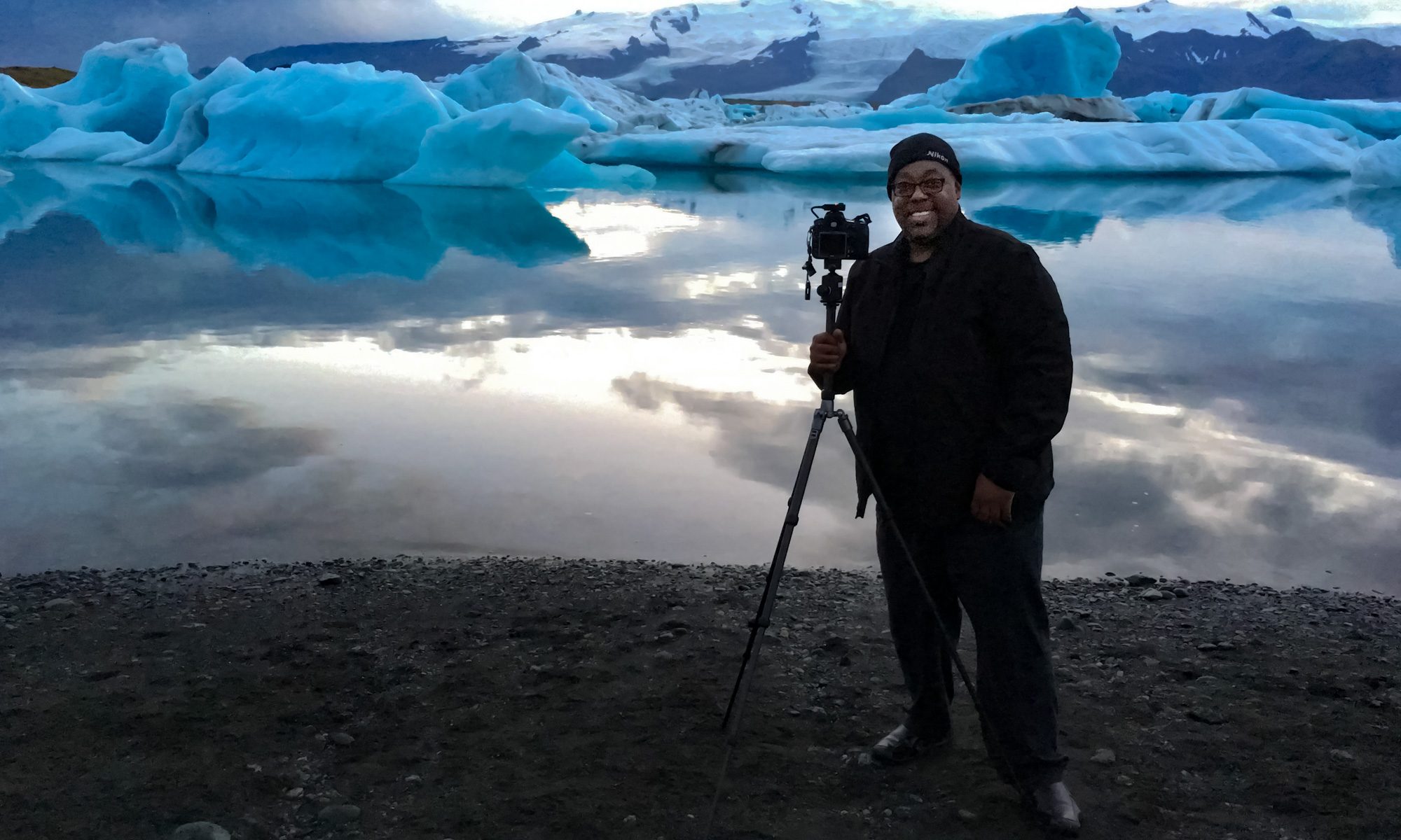
My gear, my settings
One of the biggest questions I got was “what settings did you use?” Most of what I shot was using Aperture Priority Mode. I shot anywhere from f 5.6 to f 11. Although Aperture Priority Mode works most of the time for landscapes, it doesn’t work all of the time. With Aperture Priority the camera is using its built-in light meter to set the shutter speed. It doesn’t always guess right. It doesn’t always properly expose the image especially when you’ve got a bright sky and a subject in the shadows. So in those cases I switched to manual mode and set the shutter speed to what I wanted it to be.
I used my Nikon D700 and I shot 100% in RAW. I kept my ISO at 200 and when there was a case that I needed longer exposures I used my Gitzo Traveler Tripod and Kirk BH-3 ballhead. To reduce the chance of camera shake I used a cable release. I also used my di-GPS Pro to geotag all my shots (with the exception of some of the ones in the Slot Canyons where there wasn’t a clear view of the sky for the GPS to lock on to).
My main lens on this trip was the Nikkor 14-24mm f/2.8 Lens! I was told that I would really want to use a wide angle lens for most of what I was shooting. While I do own a Sigma 10-20mm lens, I really wanted one that would take advantage of my full-frame D700. I have used/reviewed the Nikkor 14-24mm lens before. However, I don’t yet own one. The lens costs about $1,600 and I just really don’t do enough landscape shooting to justify owning it (at least not yet). So I did the next best thing. I rented it. I met the guys from LensPro To Go at Photoshop World Boston. So I decided to give them a shot and the experience was awesome. They shipped the lens and it was in EXCELLENT Condition. They even shipped it in a nice pelican case to ensure that there was no damge. I rented it for 2 weeks even though I really only needed it for one week. The price difference between 1 week and 2 weeks wasn’t that much. I also opted for the additional insurance.
If I had it to do over again…
This was an exciting trip and for the most part I got out of it everything I wanted. However, now that I’ve done it there are a couple of things I would have changed. First of all, I would have done more advance planing and research on places to shoot. I was kinda frustrated trying to figure out where to be for sunrise and sunset. Also there were places that I would have gone to, but they required permits in advance. There also doesn’t seem to be enough details out there. For example, at Rainbow Arch, you have to hike to it (like most of the attractions here). How long is the hike? A mile or 14 miles?
The next one is a little more obvious to frequent travelers. I really only needed about a day and half in Page to get Antelope Canyon and Horseshoe Bend. So there was no reason to stay there the whole time. Next time I would have booked hotels for the other nights in the other places I wanted to shoot. That way I would always wake up at the location I wanted to shoot the sunrise in instead of having to drive there in the wee hours of the morning. I would have stayed at Bryce Canyon one night and Monument Valley the next. This way I could shoot in the morning, drive in the afternoon and shoot the sunset and sunrise of the next location.
The next thing is a minor one. My rental car (a very cool black Mustang) had Sirius satellite radio. Great! However, there were times I wanted to listen to my own music, podcasts, etc. There was an AUX jack and yes I even had the right cable, but I just didn’t think it would work because the AUX button on the dash switched to the Sirius radio. So next time I would burn a couple of audio CDs. This car even had an MP3 CD player. So I could have put hours of music on a single CD in MP3 format. As a matter of fact I should just burn two CDs now (one MP3, one standard audio) now with my favorite music on them and just keep them in my luggage. That way I won’t have to think about it. I do have some loaded on the Garmin, but not enough for a several hour drive. Also with the Garmin it relies on a built-in FM Transmitter. While it does work, I’m just not a fan of FM transmitters.
FAQs
Q. I noticed you said you brought both your MacBook Pro AND your Epson P6000 backup unit. If you’re bringing your laptop, why did you need the P600?
A. Because I’m paranoid! I use the P6000 to backup immediately after the shoot while I’m still out in the field. I don’t take my MacBook Pro into field. I leave it in the hotel. When I get back to the hotel, I import the cards into Adobe Photoshop Lightroom on my computer. Then I start the review process, retouching and sharing online with friends and family.
Q. You said you used a guide at Monument Valley, but not one at Antelope Canyon or Horseshoe Bend. Is a guide really necessary? Can you just explore?
A. In all the spots I went to, you can export. Even in the Upper Slots the guide saw that I was a pro shooter and asked me if I just wanted to go shoot on my own? However, at Monument Valley, there’s no way you’re going to no what’s where without a guide. While you can certainly just pay and drive in on your own, you’re gonna miss stuff! I didn’t want to miss anything! I was standing right next to things that Carl pointed out that I would have otherwise missed.
Q. I see that your brought your Gitzo Traveler Tripod. Did you carry it on the plane? I thought you couldn’t travel with something like that for fear that it could be used as a weapon?
A. I’ve heard that too. As far as I’m concerned it’s urban legend. I’ve traveled with a tripod in my carry on luggage more times than I can count and never had an issue. As a matter of fact on the way back home I was subject to a “bag check” (a frequent thing for me). They were having problems seeing through all the electronics in my suitcase. They even pulled out the tripod, looked it over and put it right back in. The problem wasn’t the tripod, it was my Garmin bean bag mount. They couldn’t see through it.
Q. I see that you used a GPS and cable release. Is it possible to use both at the same time?
A. YES! That’s one of the main new features of the di-GPS Pro in that it has a 10 pin terminal pass-through port built in on the top. The non-pro model doesn’t have that feature.
Q. Did you forget anything?
A. Yep! I forgot to bring my hat. Luckily this time of year the temperatures are very mild. I’m not a hat guy, so I always forget to pack a hat. I have a growing “hotel gift shot hat collection” that you wouldn’t believe. I almost forgot two important pieces of gear. Since the backpack is not my everyday bag I had to pack it by taking items from the computer bag I do use every day. I almost forgot my MacBook Pro power cable and my Firewire 800 CF card reader. While I could have bought a card reader at the local Walmart, the MacBook Pro power supply would have been a little more challenging. Luckily I remembered both items at the last minute before leaving the house.
Q. Was there any technology that didn’t work?
A. There was only one small problem. I brought my GPS vent mount and the Mustang vents are circular, so I had a hard time using it and just switched to my bean bag mount (which I just happened to bring as a backup) instead.

I brought my 3G wireless card so that I wouldn’t have to depend on hotel interent. Of course this area of the country doesn’t have 3G coverage. So I ended up using the wireless at the Marriott, which was free. Otherwise, all my gear performed very well!
See all of my current gear recommendations here!
Check out my shots on your HDTV via Apple TV
If you have an interest in my photography and want to see it on your big screen and you have an Apple TV, there’s a way. Simply go to the Photos option on the menu and choose MobileMe. Select “Add Gallery” and key in “terrywhite“. You see all my public albums and any new photos I post from here on out. It’s really slick the way it works!
Otherwise you can see my Page Arizona shots here and my Monument Valley shots here.
I noticed you used both a remote release and a GPS. Is it possible to use both of these at the same time, or is it either/or?
Bob, yes the di-GPS Pro has a 10 pin terminal pass through on the top so that I could use BOTH the cable release AND the GPS.
Once again,
The jealousy sets in….
: P
Sarah K
Terry,
Great story and good advice. I just picked up a Garmin 755T the other day. It is the best GPS I have owned but I am still amazed at the ease of use of GPS devices in 2009. They really aren’t where they should be. I still get wonky routing advice in places like Chicago, not exactly off the beaten path. This is a device I would love to see Apple make or at least help out with the software.
Wow Terry! What an adventure. I think I would have been freaking out on the inside (maybe a little sweat on the outside too) on your drive to Bryce. Bryce is beautiful so it’s too bad you missed your shots. My wife and I are headed to Moab, Monument Valley and Page in a few weeks so your posts have been timely for me. Thanks for the tips. I’ll definitely try to learn from your mistakes! Thanks for posting your adventure. Even though it might have been unnerving at the time, it wil be an adventure you’ll remember the rest of your life!
Greg,
You’re absolutely right. There have been times where I wanted to get the engineers that design GPS interfaces in a room as say “what the hell were you thinking? Do you actually use your own device? Here show me how you would enter an address?”
Apple designing a GPS interface would be great!
T
Terry
Great story and wonderful pictures. FYI here is the contact details of the private guide I used at the Slot Canyons. Highly recommend her.
Carol Bigthumb (yes Bigthumb)
Adventurous Antelope Canyon Photo Tour
work 928-380-1874
mobile 928-608-7549
home email cbigthumb@yahoo.com
home page http://www.aacpth.com
RH
I must say that since I have known you, I have never conceived of you being “flappable” but after reading about the 5 hour driving ordeal ( which by the way was just great fun to read ) I still can’t imagine you being out of the cool element that I always have seen you operate in.
Great shots!
WOW again!!!! Looking forward to the adventures of Terry White – Book 2
Wow! Awesome photos and great story. I really enjoyed this post. I’ve always wanted to go to the slot canyons and your story and photos made me want to go even more. Glad you were able to have such a great experience.
LOL, that’s hilarious Terry. I absolutly feel your pain. I had the same experience getting to Great Sand Dunes NP in Colorado. I finally turned around when my poor RAV4 couldn’t rock-crawl up the mountain anymore.
Of all the times I’ve been there, my most memorable visit to Monument Valley was during an overcast day. Your photo is beautiful. NE Arizona and southern Utah are some of the most beautiful areas of our country. Look me up if you ever return to Arizona and I’ll map you out a loop of a lifetime. Heck, I may just go with you.
Dan Sorensen
Phoenix, AZ
http://www.flickr.com/photos/rejuvesite/sets
Hello Terry,
great shots and comments! I’m a big fan of that area.
The quiet and the colors are amazing. Also I took the Monument Valley tour you did.
Started 4:30 in the morning. At most I like to travel the dirt roads with a 4×4 SUV as I did the past 3 years there.
A must have to see the secrets as well as a GPS for coming back on track.
As a NAPP member I visited Scott, Dave and Matt in 2006. An unforgettable moment in my life. BTW I own all of your CS podcasts on my Mac and love it.
My hope is come to Photoshop World anytime and say "Hello" to you!
And yes Terry, I like my Creative Suite 4 so much!
Keep going your great work and blog writing and take a look on mine.
All the best,
Holger Wagner
Aachen, Germany
Great story and pics.
meta comment,
your site freezes up for i minute as a flash script fails (this is happening too much on a lot of sites- it sucks), com.kidbombay.components::Label/draw()
safari 4 mac.
Great photos
Great Story telling
Great advise…
Great mapping ???? 🙂
Been there done that and being a guy who won’t ask directions I felt for you as I read your tale.
To bad you missed Bryce, but now you have an excuse to go back and onto to Zion and hike the narrows.
Thanks for sharing.
Peter
LOL – Arizona. What don’t kill you there will make you stronger… so it can have more fun killing you later. I’m glad you lived to tell about it but think twice before you go back.
Sounds like you went up the famous (or infamous) Cottonwood Canyon Road to get to Bryce. Actually that’s a pretty good road for some of the areas here…notwithstanding the shortage of convenient Starbucks. Next time you come to Page drop me an e-mail and I’ll tell you about some more places.
Stan
Hey, is this the same Stan Burman who used to hang out at 707 Timberdell back in “the day”? If not, please excuse this intrusion! If it IS the same Stan Burman, ex Phantom fighter jock, we need to re-establish comms! Let me hear from you, okay?
D Doyle
LOL! WOW!! This post made my day!
Thank you Terry White.
A friend and I were thinking about doing this trip next week, but then we noted park hours at monument valley wouldn’t allow us to see sunrise or sunset as we wouldn’t be allowed in until half hour after the sun rose and had to be out a full hour before sunset. Sounds like this wasn’t the case though as I read your adventure……
What were the prices for access to the slot canyons, monument valley, etc. and how much was the guide?
Thanks,
carlos
Did you run into those guys in the mountains….you know …Badges ? we don’t need no stinking badges!
great shots but pack those energy bars next time!
Grüazi Terry,
Great report, really beautiful photos. The technical details are very informative. Thanks you for it.
Greetings from Switzerland
Oliver (1RAUM)
Hi Terry,
Since you have a Nikon GPS unit just take a picture of your car in the parking lot before you begin your hike. Then if you get misplaced you can take a picture and read the GPS coordinates and compare the pictures. Also you can look at yout picture sequence and get the coordinates off of each one and follow your path back.
Also while you are taking the car picture you might want to include a rear view of near by cars. In case of a break in you will have the plate number of cars that were around when you originally parked. Especially closed vans that could contain lurkers waiting for someone to park.
Terry- we went out to that area last June and my first word of advice would have been to leave the jeans at home ;-). I’m sure the weather in early spring was cooler than high summer, but for desert comfort jeans are terrible.
On a more serious note, one thing that I learned from my times in the desert is the value of environment sealing on my equipment. My first trip I had a Canon Rebel and 17-85mm (non-sealed) lens. My latest trip was with a 40D (partly sealed) and 17-40mm (sealed) lens. I missed the range and IS from the 17-85mm lens but the 17-40mm lens performed flawlessly and never got ‘crunchy’ as the 17-85mm did.
I especially appreciated that we we also did Antelope Canyon and dust got everywhere- except in my camera and lenses.
Thanks for sharing!
I live in Phoenix, and I love your narrative about the trip. I assume you learned how things run in Page; it is usually referred to as “Indian time.”
Terry, could you remove the Twitter widget from your blog page? It slows down the loading of the page by several seconds.
Thanks for your blog, Terry. I read it every day and look forward to your comments.
Terry,
Loved your story and your photographs on my apple tv! It brings back so many memories of our trips to that part of our country. It makes us want to go back! My first trip to the slot canyons 2001 was unexpected and I only had a point and shoot. I found a bracketing feature on the camera and took slots and hoped they turned out. I was blown away at my pictures. Can’t wait to go back with my slr equipment. We just might rent a 4wd and go your route to Bryce!
Enjoy reading your blog every day.
Great post. The part about the GPS giving you direction cracked my up. Too funny, only because I can relate. Yes, maps are still handy.
Terry I came by this post via your lightroom 2 webcast which was awesome. For the record I use the star method but (3 is keeper that I may work with or come back to at some point as I do find some shots I like quite well that I didn’t at first. A 4 is a printable/wall hanger photo. Call me self depricating but I never use 5s.
I was tickled as we must have passed in the night at Page. I was there on a photo trip with my dad for the long Easter Weekend with a stop at the Grand Canyon. My only disappointment was I really hoped to get into the Wave but we failed to get a lottery ticket and the trip was too spur of the moment to get the advanced lottery.
On planning I know what you mean I used Google Calendar and maps to plan possible locations, list sunrise and sunset times, phone numbers and shared them with my dad and my wife had them (updated as we went) so there was a clue as to where I would likely be. Oddly I also had a mustang (convertible) and ended up solo trying to get to stud horse point driving sandy powerline roads. I was a wee bit nervous as well…. and a 5 foot ravine/ditch prevented me from making it.
Loved the slots and oddly loved lower much better than upper and we were at upper during the peak hours.